This project is a slightly modified version of the gluon-oss-maps project, which provides a map view.
Overview of com.gluonhq.maps.

- com.gluonhq.imp.maps
- BaseMap
The BaseMap provides the underlying map tiles. On top of this, additional layers can be rendered. - MapTile
A single map tile.
- BaseMap
- com.gluonhq.maps
This is the main package with the classes to be used to show a map.- GPXLayer
This class is a MapLayer to show a GPX track (represented by a GpxType) on a map. - LabeledIcon
This class provides an icon with a label. - MapLayer
A MapLayer can be added on top of a BaseMap (which provides the map tiles).
This class only provides the framework for map layer. Any specific map layer shall extend this class and override the methods: initialize() and layoutLayer(). - MapPoint
This class provides a point on a map, which are just the latitude/longitude coordinates. - MapView
This is the top UI element of the map component. The center location and the zoom level of the map can be altered by input events (mouse/touch/gestures) or by calling the methods setCenter and setZoom.
This class is mainly a wrapper around a BaseMap.
- GPXLayer
- com.gluonhq.maps.tile
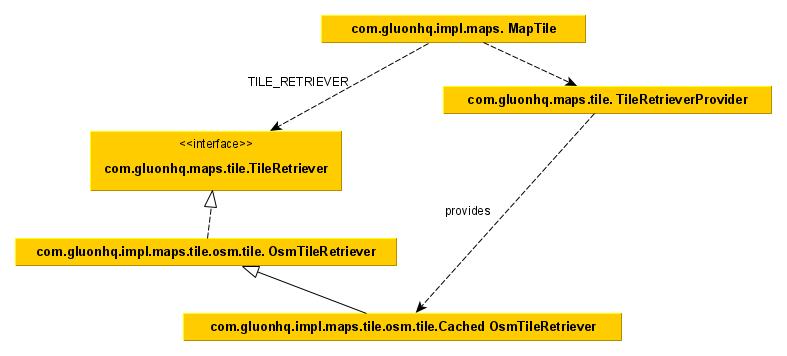
- com.gluonhq.maps.tile.tileTileRetriever
Interface to retrieve a tile, based on zoom level and tile indices. - com.gluonhq.impl.maps.tile.osm.OsmTileRetriever
TileRetriever for OSM.- com.gluonhq.impl.maps.tile.osm.CachThread
Thread to read tiles from the OSM server and store them in the cache.
- com.gluonhq.impl.maps.tile.osm.CachThread
- com.gluonhq.maps.tile.tileTileRetriever

